Thursday 9 December 2010

Snow and Old Boots

Over the past month good walks have been few and far between. In early November I took two of my granddaughters on a walk around the local footpaths, on the way we did a bit of geo caching or gee-up catching as the youngest called it. It was great fun, we pretended it as a treasure hunt (with plenty of pirate growls and pieces of eight from granddad) they found 2 out of the 3 caches we were after. This wasn’t too bad as we’re in a rural area and the iphone’s gps accuracy out here is not the best. The biggest problem of the day was persuading them that once they had found the treasure, they couldn’t take the treasure home. No tears though.

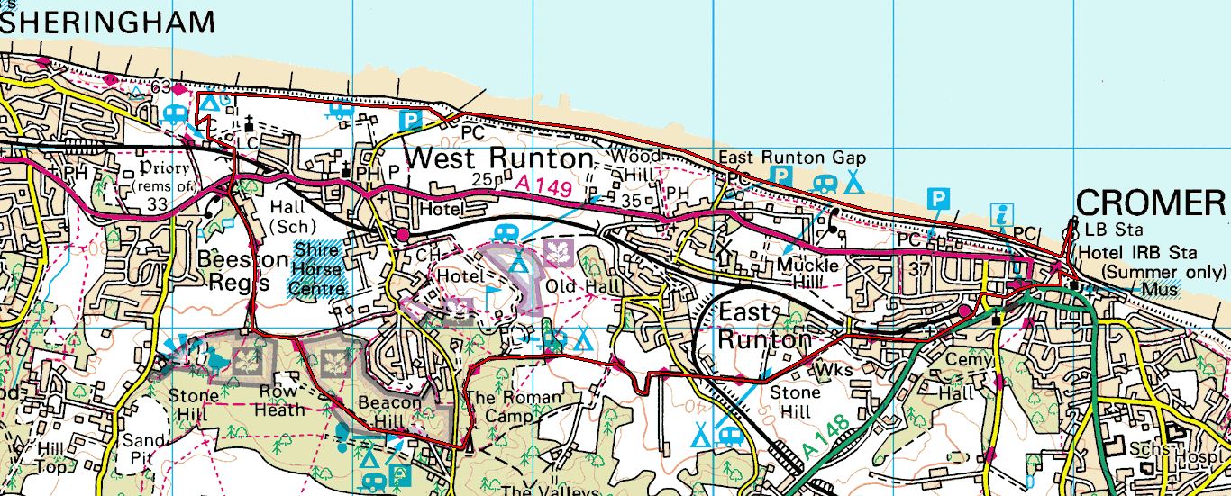
Having had a good dose of snow on 27 November, Mrs O-n-G decided that we’d go on a nice walk on the Sunday. An hour or so on the internet and memory map and we had a 9 mile walk starting from home to which I added 4 geo caches.


Sunday morning was lovely, cold, not much wind and sky was bright blue and sunny with 3 to 4 inches of snow over everything. It never ceases to amaze me how the snow changes the way everything looks, a rough old grass field becomes wonderfully smooth and the trees appear to be covered in new white blossom and the branches turn in to silver.


We tramped along footpaths across the field behind us and along the lane to the next village where we failed find our first cache, possibly because it was at ground level and on one side of the hedge the snow had drifted well into the hedge line. Moving on we walked through a series of small fields, making sure at each stile or gate that there were no cows in the field, as since a man out walking was killed by a bull and heifers over Stanford on Soar way, Mrs O-n-G is even more scared of them I can see some difficult diversions ahead. Later we watched a man fly a model jet plane, steering it through a whole range of tricks and stunts, very skilled.
I used my gps to find the next cache, it was tucked away off the main path along a track I didn’t know existed, despite a few years ago having used that area for training runs. The gps took us right up to within 3 metres of the third cache which was extremely well hidden in a tree. I’m a bit stumped here as I want to describe the situation but don’t want to give anything away, so I’ll say now’t. By now the sun was fading and it was getting decidedly colder so we headed back home by the shorter route, missing out on the fourth cache, rushing home to hot chocolate with cream and marshmallows.


Last Friday I had a day off and after finishing a few jobs took my camera off around the area taking 82 pictures of white covered scenery, some of which will appear on the Mrs’s craft Christmas Cards. Guess who gets all the printing, trimming and sticking to do.

On these last two walks I wore my Salomon 3D Fastpacker GTX mid boots (or some such name). I bought them just over two years ago, I’ve only worn over winters as I much prefer approach shoes most of the year. Wearing them on Sunday I had forgotten how comfortable, supportive and light (990g a pair) they are. I was also pleased with how well they worked in the conditions, they also felt 

Intrestingly these are the only boots or approach shoes I have worn in the last six years that I have not had to put either Superfeet of the Montrail insoles into. Last spring I thought they had started to leak through the tongue area but in the snow there has not been any leaking. I guess snow may not be a good test of waterproofness so I’ll have to wait and see. But with the Smartwool socks I was warm and dry. I might give the 3D shoes  (without GTX) a try in the spring.


Tuesday 16 November 2010

Not a review of the Osprey Stratos 36

Three weeks ago when I walked around the top of Langstone Harbour I carried my old Vaude Tour 45 rucksack and I hated it, which is sad ‘cos I’ve have carried it most winters and some summers for at least five years. This year I wore my Osprey Atmos 50 a lot more, mainly so that I could sort out what I was going to carry on our Lakeland Circle Walk and then over a few walks work out how to pack  the sack.  During our Lakes walk the Atmos, the kit and the packing worked a treat no faffs and things to hand as needed. Now carrying the Vaude for the first time in months it felt, and looked, as if I was carrying a bag of spanners.

So we paid a visited Snow and Rock at Porchester to try on a few rucksacks.  Then a couple of days later, to make sure, I called into Cotswolds in Nottingham a to try a Deuter I’d read about, but also to see if they had a Stratos 36 in, they didn’t but after chatting to the guys in store, I wanted the Stratos.

A quick scoot around the interweb and I placed an order with Taunton Leisure.


At this point I was going to write“a review” but having read a couple of anti gear review reviews I think we’d all be happier if I just tell you what I like and dislike about the Stratos and the bits I’m still thinking about. I should also say that I have only worn it lightly loaded on two short walks, which probably makes the whole thing invalid, to serious gear reviewers.

Anyway, the utmost likes are the hip belt and airspeed back, these are the reason I bought this sack. The Atmos which has a similar belt and back has been wonderful, stable, comfortable, it stays cool on warm days, a joy to carry and I can feel that the Stratos will be much the same.

Then there are the things I have discovered, the pouches on the hip belt are a good size taking my camera and several bars of chocolate for the grandkids, Also for the first time with any of my rucksacks I can actually get my hand into the wand pockets while wearing the sack. And just to prove that I am only interested in the gimmicks I really like the MP3/phone pouch on the right shoulder strap, just right for the iphone.

As far as carrying goes it, with the limited use I’ve had, it give that ‘right’ feeling, the hip belt sits well and is easy to adjust as are the shoulder straps, as you’d expect. The water pouch can be hung outside the bag between it and the airspeed trampoline. This frees up room in the bag and moves weight closer to the back. The compression straps, despite the top ones looking a bit odd pull the sack, when lightly loaded, into a quite narrow and not to deep shape.


Dislike, so far, I don’t like that there are no loops or D rings on shoulder straps which is where I prefer to hang my GPS from. The Stratos has the stow on the go wizzywig that allow walking poles to be stowed on a bungy cord under the left arm pit. Now being a gimmicks person I was quite excited about this and took my walking pole out for a walk and a carry, and I hated the stow and go. If this was a proper review I would explain how it works and why it didn’t for me, but I’m not. It was a pain. But on the bright side the bungy bit does give me a loop to hang my GPS from.
There seem to be a lot of straps on the sack all with very long flapping around tails or waste I think they’re called. All will have to be tested for length, cut, sealed and sewn up again.


The things I’m still thinking about are the colour, black and slate, the materials and the loading, what goes where and in what order, that will take a couple of walks to sort out. I also don’t understand why there are two top pockets in the lid instead of one big one, save a zip and the material that divides them, then there’s the big zip that opens up the main compartment, why. I’ve already mentioned the top compression straps, they probably do a good job but they look odd, and foul the big zip to the main compartment and seem awkward with the straps pulling the lid down.
So it looks and feels good, a bit of practice and learning to do yet and I am looking forward to a good long walk with it. Finally, as I have been known to say about other people’s reviews, if he’s paid that much for it, he’s bound to say it’s the best thing since sliced bread, aren’t I

Tuesday 2 November 2010

Langstone Habour Farlington to Emsworth

Date: 30 October 2010
Area: Farlington to Emsworth, Hampshire
Distance: 9 Miles 14.5 k
Start Location: Farlington Marshes Car Park
OS Sheet: Explorer 119 and 120
Grid Ref: SU 6755 0429
Outline: Farlington Marshes, Havant, Langstone, Warblington, Emsworth


Route
These notes are provided to enable the walk to be plotted on a 1 : 25,000 map. They are not walking instructions.
I left my mother in laws house in Farlington, walked down the Eastern Road, past Sainsbury's and the Hilton, then under the M27 to the start of the walk in the Farlington Marshes Car Park overlooking Langstone Harbour.
From here head east along the sea wall around Farlington Marshes, into the Hermitage River and under a road bridge where you turn sharp left up the bank to join the road above, head east. After about 400 metres take a path on the right following a small stream south towards the sea, head east and cross the footbridge into Langstone.
Continue to follow the sea wall east, then cross the field to Warblington Church. Take Church Path across the fields until the sea wall and beach leads you around to the huge Mill Pond from there, there are various routes open to you to explore Emsworth.
Journey
As we were in Portsmouth to see my mother in law I was looking for a walk to do while Mrs O-n-G spent some time with her mother. Looking at the maps this walk seemed to link together a number of places from my childhood and later when working in Havant and offered the choice of bus or train for getting back to Farlngton/Cosham.
The day started off with a lovely big blue sky and a warmish breeze, the tide was out leaving the harbour a flat, grey and green desert with the sea a glimmer in the far distance. Luckily, the cool weather meant the never to be forgotten smell of rotting sea weed was thankfully missing.

The walk was largely flat and generally followed the sea wall. Several long distance walks cover the same ground, the Langstone Habour Waterside Walk seemed to predominate, I also spotted signs for the Wayfarers Way and the Solent Way.
As I walked around Farlington Marshes the twitchers were out by the by the score, some with camera lenses on tripods  looking like anti-tank rocket launchers, or camouflaged heavy machine guns, just right for sorted the geese out. Although the way the twitchers blocked the path it was them that needed sorting.


Some of the walk is quite close to the M27 and to the south of Havant through an industrial estate, past a sewage treatment plant and a sand and gravel quay. It added interest and makes one appreciate the wilder countryside.
In Langstone I got to walk along a track that had once been the railway line for the Puffing Billy, a steam train that ran from Havant to the sea front at Hayling, the highlight of the 50’s for me.

Crossing the road into old Langstone I had a look in the Ship Inn and around the corner the Royal Oak both well visited in the 70’s  I wanted to see if they had changed much but I couldn’t tell, it was like I was seeing them for the first time.
The old cottages, the mill and mill pond didn’t appear to have changed much. The mill was one of a large number along this coast that were built in the late seventeen hundreds to grind grain and gun powder to be shipped to Spain and Portugal for the Armies fighting in the Peninsular War. 

While looking at the maps I was intrigued by a right of way shown on both 50,000 and 25,000 maps as crossing the harbour from Langstone to Hayling, to the east of the present bridge. I did a bit of searching on the internet and found out that it’s the route of an early medieval track way, see link below. Needless to say I couldn’t spot it.
Warblington Church is well worth a visit it is unusual and picturesque and it is one of those places that makes you feel the past is not so far away.


Unfortunately, Emsworth disappeared in a prolonged shower of cold rain and as I reached the town center my bus pulled up so in seconds I was on my way back to find out how Forest got on against Pompey.
This was an interesting and enjoyable walk with plenty to see and I’d rate it as a good walk albeit very different from the quiet, more rolling countryside I am used to. Perhaps next time I’m down I’ll catch a bus to Emsworth and have at look around and see what I missed this time.

Monday 11 October 2010

Beeston Regis to Cromer

Date: 9 October 2010
Area: North Norfolk Coast between Sheringham and Cromer
Distance: 8 Miles 12.8 k
Start Location: Beeston Regis
OS Sheet: Explorer 252


Journey
We were kindly offered a free weekend in a friend’s holiday home (caravan) at Beeston Regis, on the Norfolk coast, just along the coast from Cromer next door to Sherringham. So on Friday Mrs O-n-G and I headed out along the A47 to Kings Lynn and up the A148 to Beeston Regis.
During a quick visit into town on Friday morning for bits and bobs to take with us, I was lucky enough to get the OS Explorer 252 map, Norfolk Coast East in WH Smiths.
On Saturday we went out without much of a plan other than walk to Cromer. From the caravan we headed towards the sea and turned right, walking east along the cliff tops. It was a grey and misty day with a cold wind, the sea was full of white horses and big rolling breakers. The cliff top edge was well fenced off for safety with frequent notices warning of the erosion, the instability of the cliffs and the danger of getting to close to the edge.


At West Runton we dropped down the road to the slipway and headed off along the beach. Please check tide times and state before walking along any beach. From the shore looking up it becomes clear why the cliffs are eroding, basically because they are, at a guess, largely formed of clay with some weak sandstone.


As we moved along the beach stopping to pick up stone of interesting shapes and or colours, and looking in rock pools we could see where, in the recent, past the cliffs have collapsed leaving water pipes and drainage pipes exposed. In several places, we saw concrete slabs that had once been the bases for mobile homes to stand on, lying half way down the slope and protruding out at the top of the cliff. Later we came across a World War 2 Pill Box, constructed in about 1940 as a defence against possible invasion, now laying on its side nearly buried by sand. I paced out the distance from the pill box back to the base of the cliff and estimated that the cliff here had retreated some 50 metres in 70 years.


On reaching Cromer we bimbled along the Promenade and eventually ended up on the pier watching the fishermen, while down on the beach we watched the surfers including a group of youngsters being taught.


Feeling colder by the minute we walked up past the Church and into the town stopping for  hot drinks and toasted sandwiches. Feeling refreshed we had a look at the map and worked out a route back to the caravan using the Norfolk Coastal Path. The chap running the Café gave us some directions to the A149 where we could pick up the NCP, but could only explain the way as if driving, when told we weren’t in a car he could only point vaguely and say that way.

After a short trip around Morrison’s car park, the railway station “North Norfolk Railway” and the back of Halfords we went up the A149 into Sandy Lane, and follow the Norfolk Coastal Path ‘Acorn’ signs across Stone Hill, along Cross Lane and into a long stretch of woodland, passing a couple of nice looking caravan and camping sites and working our way uphill to cross a different Sandy Lane, south of West Runton.


Here we crossed into Roman Camp Wood, the high point of the walk at 102m, with its pay and display car park and a very nice interpretation board which carefully explains that no Roman remains have ever been found here. From here it was follow the NCP through more woodland gradually dropping down off the hills out into fields, past Beeston Hall School and across the road to the caravan.


A very varied walk and despite the grey weather very pleasant, although I have to say that due to the high hedges in the rural bits, lots of trees in the wooded bits and general lack of elevation there were few good views on the Norfolk Coastal Path more a sort of few good glimpses.

For us it was just the first taste of somewhere new, although we had visited Cromer for a day with our children some 30 years ago during a holiday touring with the caravan. And now it is somewhere we will come back to, to explore further.

Wednesday 29 September 2010

Day 0 Travel to Windermere.

Date: Saturday 11 September 2010

Journey 

I met up with A. in Derby as arranged. Now after many months of planning and talking  our 75mlie walk around the lakes was off to an unhurried start with a train journey to Windermere, changing at Crewe on the way.

On landing in Windermere we went along to the Independent Backpackers Hostel and booked in. We were very surprised to find that we had been put in a four bed room (two bunks) with two young Malaysian girls. This was not a situation we were happy about, and I’m certain the girls weren’t either.

After a stroll around Windermere we had a decent meal in an Italian restaurant, then a few beers in the Queens with a large family of guys from Wales who were also at the hostel, who had  walked up Scafell earlier in the day, it was a good night.

Day 1 Summit and Views

Date: Saturday 11 September 2010

Journey 

I met up with A. in Derby as arranged. Now after many months of planning and talking  our 75mlie walk around the lakes was off to an unhurried start with a train journey to Windermere, changing at Crewe on the way.

On landing in Windermere we went along to the Independent Backpackers Hostel and booked in. We were very surprised to find that we had been put in a four bed room (two bunks) with two young Malaysian girls. This was not a situation we were happy about, and I’m certain the girls weren’t either.

After a stroll around Windermere we had a decent meal in an Italian restaurant, then a few beers in the Queens with a large family of guys from Wales who were also at the hostel, who had  walked up Scafell earlier in the day, it was a good night.

Day 2 Bogs and Bridges

Date: Monday 13 September 2010
Area: Lakeland
Distance: 13.8 Miles 22.2K
Start Location: Patterdale
OS Sheet: Explorer OL5 & OL4
Outline: Patterdale – Aira Force- Dockery – River Greta – Thelkeld – Keswick


Journey
Monday started dry but cool and overcast we got out the YHA about 09:20am, nipped into the Post Office for sandwiches and chocolate and walked up to the bus stop to catch the bus (to avoid a long and possibly dangerous road walk) to Aira Force. Already at the stop were  5 yanks from Oregon and we had a great twenty minutes or so chatting about visiting each other’s countries , the Coast to Coast, from which they were catching a bus to Penrith and on to Shap to avoid what they had been told was the hardest day. They were amazed that we were walking in approach shoes not boots, we tried to educate them.

Aira Force had a lot of water coming down it, and I came to realise that if you want to take photos of waterfalls it is probably better walk down hill not up, discuss. From Dockray, we’ve been here twice before but never when the pubs open, mustn’t let that happen again, we walked up the road west out the village. It started raining about half way up and by the time we reached the cross roads at the top, it was pouring. We remained in full waterproofs the rest of the day.

Going straight across the cross roads and on westward along the Old Coach Road towards Keswick we quite quickly picked up the post marking the footpath that crosses Sandbeds Moss, Barbaryrigg Moss, Whitesike Moss and a whole load of other bogs. We were wet up to our calves in water in the first 50 metres, after that it was bog plugging till we reached Lobbs Farm some 2k later.
Passing through Wallthwaite and Guardhouse we eventually joined the path along the River Greta then swapped to the old Penrith to Keswick railway line outside Threlkeld.  Here I think we made a mistake, which had some bearing on the next days walks, with hindsight we should have diverted into Threlkeld  to get something  to eat and drink in the warm and dry and have a rest. We didn’t as we thought Keswick was not too far away and as the YHA is open all day we could go straight in get warm etc.


The railway walk is great, I’ve done some of it before, but this time in the rain it seemed to go on for ever. Even so we were impressed by the bridges, if I remember correctly 8 railway ones over the river, 2 road ones over the railway and river?, a tunnel and the boardwalk diversion.  Also impressive was the state of the river, dingy brown with white foam, with large volumes of water pouring in off the hills. We reached Keswick YHA at about 4:00pm with 13.8mile on the GPS.
Washing done and shoes stuffed with newspaper and put in the drying room we walked into town and had terrific meals in the Keswickian Fish and Chip shop, restaurant (downstairs) opposite the Moot House and had a few beers in the Dog and Gun, it was still raining when we left.

Day 3 Streams and Screes

Date: Tuesday 14 September 2010
Area: Lakeland
Distance: 12.5 Miles 20.1K
 Start Location: Keswick
OS Sheet: Explorer OL4
Outline: Keswick – Braithwaite - Coledale Hause – Gasgate Gill - Loweswater – Buttermere
Journey
Leaving Keswick proved a bit difficult due to some faffing about. First I decided that as I had experienced some pain and stiffness in my left knee while coming down from High Street on Sunday and again while walking along the railway line to Keswick on Monday, and since the next two days included a fair amount of climb and descent, I wanted to buy a cheap walking pole to help the knee, naturally several gear shops were visited before the right pole was found, at the right price. Then half way to Portinscale we both realised that in the excitement of me actually buying pole, after all I said about them, we forgot to draw out money for the next three days, so we retraced our steps back to the Coop to use the ATM, eventually got away about 10:30am.

On the way through Braithwaite we felt compelled to stop at the Café in Scotgate Holiday Park for tea/coffee and homemade cakes and get a brochure for future visits with family. From our quick visit it looked a very good site.

Finally we made it to the start of Coledale, so far the day had been fine and sunny with a gentle but cold wind. Walking up the valley the surrounding hills came in to view and it was obvious that the weather was about to change.  Approached the workings below Force Crag Mine the wind got up and the rain started, so we decided to move up to the mine buildings to shelter and kag up. Passing the ford where the track up to Coledale Hause starts, two men came across dragging a large bundle of what looked like wire fencing, although we exchanged a few shouted comments we got no clue as to what they were doing and they walked off down the valley.

Close by was a very small tin hut which we dived into, through a hole where a corrugated iron sheet was missing. There was a 150mm dia. plastic pipe passing through the hut about waist height and with two of us and rucksacks in it, it was crowded. Then the wind and rain really set in, the hut vibrated and trembled and the noise was at times deafening. The rain was ferocious as it lashed across the hillside. So we stayed put, had a brew and eat our sandwiches. As we looked out we could see the stream rising and watched as several people struggled to cross.


After about an hour the rain subsided, we climbed out the hut, looking around to work out how we could continue. It was clear that we could not cross the ford, people coming down that way were continuing to walk down through the heather on the south side of the stream. We spotted more people scrambling down below a small crag to the north of the stream and on talking to them it seemed that, that was the only way up available to us, one guy said it was a fairly well used route, so up we went. The best I can say is it’s definitely not a backpacker’s route, we scrambled, slipped and struggled but made it, out of breath but in one piece. Then pressing on over Coledale Hause we entered into a different world, Gasgale Gill.

As we started down the Gill with the Liza Beck on our left the sky cleared and the sun came out, Gasgale Gill was simply stunning, I have never seen a more beautiful place in the Lakes possibly in England, it felt almost Alpine and it is nearly three kilometres long.


Due to the rain the beck, which pretty much fills the floor of the narrow, steeply sloped valley, was a living mass of white foaming, steaming, riving water smashing into and over the massed rocks and boulders that lay in its way. The noise was deafening and as the path which clings to the heather, rock and scree is often only a foot or so from the water, with the flying spray, at times you felt you were breathing the water. The heather, crags and screes all form a backdrop to, on this day, the becks master class performance.

After so much noise and excitement the Gill ends in an anti-climax, you cross a footbridge turn a corner and you’re out in the open on a grassy field, the becks gone, its noise abated and a bus trundles by on the road  a couple of hundred meters away. Since getting home I’ve read that Gasgale Gill was once a packhorse route, which surprised me considering how tenuous the path was across the scree slopes and along by the beck.


From here the original plan was to walk west around Crummock Water and along its south side so as to come into Buttermere from the south. Due to the time we had lost earlier we decided to turn east and take the lakeside path and road to Buttermere. This looked to be a pretty straight forward four – five K walk. We went by Lanthwaite Green Farm, through the woodland to the Boat House, then headed east along the shore only to find a fifty metre section of the path was now in the lake, as our feet had been wet for several hours already, we just stepped in and splashed through the waves, back on the path and about a K later re-joined the road. A brisk road walk is great for warming up wet feet so we were feeling fairly happy about things until out of a clear sky we got twenty minutes of rain which ended as reached Buttermere. We got to the YHA at about 6:30pm with 12.5 miles on the GPS.

Although we did our usual washing and put it and our shoes in the YHA drying room, it was not very warm and little drying was done overnight, which was a shame as in all other respects the Hostel and staff were great.

Despite the efforts of a group of about twenty people who disturbed everyone by rearranging the dining area so they could all sit together in one small corner, we had a good meal and a few pints in The Fish in Buttermere.

Day 4 Rain Stopped Play

Date: Wednesday 15 September 2010
Area: Lakeland
Distance: 12.6miles 20.3K
Start Location: Buttermere
OS Sheet: Explorer OL4 & OL6
Planned Route: Buttermere – Ennerdale – Wasdale – Eskdale
Map shows planned route.

Journey

Tuesday night sleeping was difficult. The wind blew, the sash windows rattled as only sash windows can and the rain was near non stop, it even drowned out A’s. snoring , that takes some doing. I wear industrial ear plugs and was wakened again and again as the rain and wind lashed against the window. In the cold light of day things seemed worse, the trees outside the YHA were dancing like dervishes and the fellside across Buttermere was just about invisible.
This day, Buttermere to Boot via Wasdale was the one we had been looking forward to. In 2007 on the Cumberland Way we walked from Wasdale YHA  to Buttermere YHA and it had been one of the best days on that walk.  This time the plan was to walk along Buttermere up to Scarth Gap, down to Black Sail Hut for a brew, then then up to Black Sail Pass and down to Wasdale Head for lunch and on to Boot.
Over breakfast we discussed options, looked at weather forecasts, maps, time tables and pamphlets only to learn that Buttermere to Boot are possibly the worst places to travel between, in the Lakes, if not on foot. The arguments to walk or bus went around but when we got to consider the streams we would have to cross, remembering how ferocious the streams had been yesterday and weighing up how a night of rain would affect them I gave in to public transport, at that point I distinctly felt my age catch up on me.
We caught the bus to Keswick passing through Lorton Vale and Whinlatter to get into the bus station outside Booths, just in time to catch a bus to Workington. This took us through Cockermouth, now I’ve been up and down the A66 before but I’m sorry to say I’ve never been into Cockermouth. Like many people my only knowledge of the town is what we’d seen on TV following the floods. As we passed through I was quite taken with the look of the place and told myself, and anyone reading this, that I must visit it again, properly (is anyone reading this?).
We had a brief look at bits of Workington before catching the train to Ravenglass, as we travelled down the coast the sea state was rough with some hefty looking waves pounding the shore. From Ravenglass we climbed on La’al Ratty and  pulled by a steam engine we trundled to Dalegarth, before walking up to the YHA, stopping at the Woolpack on the way to peruse the Menu.


After sorting out our still wet clothing and shoes in the lovely hot drying room, it’s strange how important these things can become, we went to the Woolpack for a lovely meal and a few pints with Andy and Martin from Hubberton Hikers who were recce’ing a walk, sound like a good excuse. Another good evening.