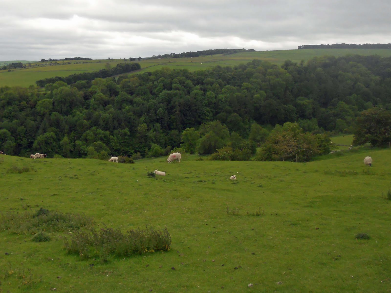
In the past few years my mate Andy and I have walked most of the main hiking routes through the Lakes, the Coast to Coast, the Cumberland Way (amended a bit), the Westmorland Way, the Cumbria Way (twice both from Carlisle southwards) and last year our own Lakeland Circle, described in Lakes 2010 .
This year after much discussion and persuasion Mrs G finally agreed that she would go on a long distance hike with me. We choose the Cumbria way as I know it, it gives a good view of the Lakeland hills, it is mainly a valley walk with only one major climb south of Keswick, over Stake Pass from the Langdales into Langstrath. Also from previous holidays and visits, many parts would be familiar to her. There were, however, two cast in stone stipulations, she would not stay at a YHA and she would not carry a rucksack, I had already confirmed I would carry as much of her gear as I could, but she had to carry some of her own stuff. We bought a bum bag.
A number of training walks were planned locally, then in the Derbyshire peaks just to get us back into the level of walking fitness needed, to enjoy a multi-day walk. At the same time I started drawing up the ‘kit spreadsheet’ and ‘kit to buy list’ both essential planning tools.
Over the past few years I have gradually reduced the packed weight of my rucksack, with lighter gear and much less of the extras, those just in case bits and bobs that get stuffed in at every opportunity. Also it was clear that in the past the biggest weight burden was the ‘going down the pub clothes and shoes’. With me having to carry more or less two lots of kit these were clearly the areas to be controlled.
Although we both had previously bought some Paramo and other bits and pieces this year the only kit bought for the walk were RAB Aeon tee shirts for both of us, new Thorlo socks for me and a couple of small dry bags, a second bum bag and then just before we started a Vaude Triset 15 rucksack.
I was to carry, two Paramo Velez AL, two cheap over trousers, my TNF Apex gillet, my hat, gloves and buffs, a small dry bag holding my trousers, t-shirt, underwear, socks and washing gear in a plastic bag and very light shoes for indoor use. Plus maps, thermos, Source water bag, two sit mats and other bits gave me a packed weight of 9.2kg excluding water and food. Mrs G carried her TNF Apex gillet, hat, gloves and buffs and several other items of a vital nature, having ditched the bum bags the Vaude weighed in at 1.4kg.
We were using a wet clothes/dry clothes system. Each night we changed into dry kit washed out socks and underwear and dried them along with any damp day clothes. If the day kit did not dry, the next day they are worn wet, dry clothes must be kept dry.
Then at Easter disaster struck Mrs G smashed her toe on the wardrobe and was unable to do much walking for several weeks and nothing serious until late May. So much training and fitness was lost and her foot was still very tender.
All the B&B’s were booked in March, we had planned to go up and back by train but that proved too expensive for one let alone two.
So on 11 June we drove up to Keswick, the M6 south of Penrith is stunning. We parked the car and a suitcase of clothes in Keswick and caught a bus to Ulverston via Ambleside. We sat upstairs all the way, it was truly wonderful. It was a sunny day and we could see so much more of the hills, lakes, towns and villages than we have ever done in the car particularly for me, the driver.
Having found our way to the B&B via Laural and Hardy we went out for a quick look around Ulverston, making our way up to the official Cumbria Way start point in The Gill before finding somewhere to eat. Thank you, to Lee at the Farmers Arms who kindly booked us a table in the Rose and Crown. Both pubs are in the same ownership, I think. Two very good meals were had and we chatted with some very friendly people.
Journeys on Foot allows me to share with others the walks I have devised (or occasionally copied) and walked with family and friends. Plus the occasional rant, kit chat or comment on anything.
Sunday, 26 June 2011
Cumbria Way - Ulverston (Gawthwaite) to Coniston (11m)
Day one 12 June
Our B&B at Sefton House was the most expensive on the trip and I am afraid we found it to be a disappointment.
Having walked to Ulverston before I knew the first few miles of the Cumbria Way were not very special, so to shorten the 15 miles on the first day and reduce the strain on Mrs G toe, we had decided to take a taxi up the road to the edge of the National Park at Gawthwaite. Our driver was Alan of LA12 Taxis, we recommend him highly he was punctual, knowledgeable, friendly and humorous.
As we walked northwards we could see the Coniston fells in the distance and for a short while as we looked back we could still see the lighthouse shape of the Hoad Monument outside Ulvertson.
The day so far was mild but cloudy with a strongish wind from the south west. This is an landscape of stone walls, fields, copses, streams and rough moorland that is pleasant enough to view and walk through. I had thought that having walked south I would be ok going north but a couple of small navigational errors soon brought the reality home, I had to keep good map contact. High Stennerley and Kiln Bank came and went as we approached what on previous walks had been one of the high points of the day, the walk along the east side of the ridge north of Tottlebank. However, dropping down the hillside towards the track up to Tottlebank I heard a scream and a shout from Mrs G ‘it’s a snake’. As I came back up to her I saw a green and black snake about 30mm diameter and 3-400mm long, so I took a couple of photos as it hissed at me.
Mrs G said ‘I nearly trod on it, what is it’.
Naturally I said ‘it’s a snake’, which earned me a thump, ‘I don’t know’.
I think it’s an Adder’ she said.
’Never mind it’s gone now’ earned me another thump.
Eventually we got moving and I told her about the snake I had seen on a walk last year in Leigh Park (near Havant, Hampshire) which was bigger but looked the same, ‘what was it’ she asked. Avoiding another thump I explained that I didn’t know as I hadn’t looked it up, which got me another thump. We moved rapidly along past Tottlebank and on to Beacon Tarn.
By now the wind was getting up and there was wetness in the air and the temperature had dropped about 5 degrees C. We had planned to have dinner here but decided to go on to Sunny Bank which would be more sheltered so we pushed on along the side of the big wet area of Stable Harvey Moss, past Tottle Bank (confusing) up the track and down across the Torver Beck footbridge where we finally put our jackets on, then over the A5084 and down the hill to the Sunny Bank jetty where we had lunch. So far we had only seen a group of three, father, daughter and boyfriend on the Cumbria way who overtook us at Beacon Tarn, two sets of dog walkers at Beacon Tarn and a couple who were walking south out of Torver Low Common.
The rain persisted in a miserable damp sort of way all the way to Coniston with little to see but trees and water plus a couple of groups of school learning sailing and canoeing.
As we walked across the fields into Coniston the drizzle lifted and the sky brightened. Crossing over the bridge we stood for a minute getting our bearings, when a lady brushed past saying ‘it’s over there’, ‘what is’ I said, ‘the cash point’ she replied, disappearing around the corner. ‘allo , allo ‘ I thought.
Ten minutes later, after looking at pub menus and shop windows we walked down Tilberthwaite Avenue past the Crown Inn and into Lakeland House Hotel webite is is a very good, clean efficient, friendly, everything you want a B&B to be, place. We did not fault it. However, the room was small, so small, we had to shuffle around sideways between the bed and wall. At least there would be no midnight hikes to the toilet, in fact, at first we couldn’t find the toilet until I opened a pair of small white doors, which I’d thought was a built in wardrobe and found the Ensuite. There was not a lot of room in there either but the shower was good.
‘I’m just going in the cupboard’ became the standing joke of the holiday.
A good meal in the Crown Inn rounded off the first day.
Our B&B at Sefton House was the most expensive on the trip and I am afraid we found it to be a disappointment.
Having walked to Ulverston before I knew the first few miles of the Cumbria Way were not very special, so to shorten the 15 miles on the first day and reduce the strain on Mrs G toe, we had decided to take a taxi up the road to the edge of the National Park at Gawthwaite. Our driver was Alan of LA12 Taxis, we recommend him highly he was punctual, knowledgeable, friendly and humorous.
As we walked northwards we could see the Coniston fells in the distance and for a short while as we looked back we could still see the lighthouse shape of the Hoad Monument outside Ulvertson.
The day so far was mild but cloudy with a strongish wind from the south west. This is an landscape of stone walls, fields, copses, streams and rough moorland that is pleasant enough to view and walk through. I had thought that having walked south I would be ok going north but a couple of small navigational errors soon brought the reality home, I had to keep good map contact. High Stennerley and Kiln Bank came and went as we approached what on previous walks had been one of the high points of the day, the walk along the east side of the ridge north of Tottlebank. However, dropping down the hillside towards the track up to Tottlebank I heard a scream and a shout from Mrs G ‘it’s a snake’. As I came back up to her I saw a green and black snake about 30mm diameter and 3-400mm long, so I took a couple of photos as it hissed at me.
Mrs G said ‘I nearly trod on it, what is it’.
Naturally I said ‘it’s a snake’, which earned me a thump, ‘I don’t know’.
I think it’s an Adder’ she said.
’Never mind it’s gone now’ earned me another thump.
Eventually we got moving and I told her about the snake I had seen on a walk last year in Leigh Park (near Havant, Hampshire) which was bigger but looked the same, ‘what was it’ she asked. Avoiding another thump I explained that I didn’t know as I hadn’t looked it up, which got me another thump. We moved rapidly along past Tottlebank and on to Beacon Tarn.
By now the wind was getting up and there was wetness in the air and the temperature had dropped about 5 degrees C. We had planned to have dinner here but decided to go on to Sunny Bank which would be more sheltered so we pushed on along the side of the big wet area of Stable Harvey Moss, past Tottle Bank (confusing) up the track and down across the Torver Beck footbridge where we finally put our jackets on, then over the A5084 and down the hill to the Sunny Bank jetty where we had lunch. So far we had only seen a group of three, father, daughter and boyfriend on the Cumbria way who overtook us at Beacon Tarn, two sets of dog walkers at Beacon Tarn and a couple who were walking south out of Torver Low Common.
The rain persisted in a miserable damp sort of way all the way to Coniston with little to see but trees and water plus a couple of groups of school learning sailing and canoeing.
As we walked across the fields into Coniston the drizzle lifted and the sky brightened. Crossing over the bridge we stood for a minute getting our bearings, when a lady brushed past saying ‘it’s over there’, ‘what is’ I said, ‘the cash point’ she replied, disappearing around the corner. ‘allo , allo ‘ I thought.
Ten minutes later, after looking at pub menus and shop windows we walked down Tilberthwaite Avenue past the Crown Inn and into Lakeland House Hotel webite is is a very good, clean efficient, friendly, everything you want a B&B to be, place. We did not fault it. However, the room was small, so small, we had to shuffle around sideways between the bed and wall. At least there would be no midnight hikes to the toilet, in fact, at first we couldn’t find the toilet until I opened a pair of small white doors, which I’d thought was a built in wardrobe and found the Ensuite. There was not a lot of room in there either but the shower was good.
‘I’m just going in the cupboard’ became the standing joke of the holiday.
A good meal in the Crown Inn rounded off the first day.
Cumbria Way - Coniston to Great Langdale (11m)
Day two 13 June
After a good night’s sleep and a very decent breakfast we stepped out into the misty morning, quickly realising that waterproofs would be in use again today. Leaving the road and heading up through the fields and trees we could see a lone walker some 300 to 400m in front of us, we lost sight of him when we stopped to Cag up in the woods at the top of the hill before dropping down across more fields to Low Yewdale. Walking uphill through Tarn Hows Wood, we eventually came out on to the road, just past Town Hows Cottages. Despite the rain and mist this was a delightful walk with the sheep and lambs, trees and woodland, rolling contours and misty views
We reach the Tarn Hows car park at about ten o’clock and cars were in the car park already and the ice cream/snack van was in operation. The rain mist and murk did little to spoil the beauty of Tarn Hows or that something special feeling that walking around the tarn gives, even though it made photography a nightmare.
Tarn Hows and the track out to High Oxen Fell Cross, brought back very happy memories of long ago holidays with friends and children who now have children of their own.
After crossing the A593 despite watching two pairs of walkers go the right way I had a total navigational brainstorm and took us off the wrong way, adding about half a mile and two steep hills to the walk. Sorry Mrs G. Eventually we reached High Park and crossed the field to the woodland where there’s a choice of routes one straight through the wood the other northeast and down to the River Brathay and Colwith Force, joining back with the main track a bit later. The path down to the River was quite slippery but worthwhile once we saw the river and falls. On previous visits water levels had been low, not this time, today they positively roared.
Shooting past Park Farm and Park House we made best speed to Chesters at Skelwith Bridge. This is a must place to go, it is as far from a greasy spoon, or one of the old hiker/climbers café as you can get, on a wet day it was crowded, however, the food is great. Everything is made in the kitchens here. We can recommend the house soup and as many of the cakes as you can eat (afford). This was my fourth visit. I generously emailed a couple of photos of the cakes to Andy. From his response I have to say jealousy is a sad thing LOL.
Later in the afternoon we pushed on through Elterwater and Chapel Stile where we bought some tins of fruit, biscuits and chocolate, and had an ice cream. Carrying on along the Way we quickly reached our turn off for our B&B at Robinson Place Farm. On reaching the road we stopped to sort out if it was left or right, when a chap came down the road from the right, he was also going to Robinson Place which was a 100m or so to our left. As we walked up the track to the farm I realised that this was the lone walker we followed out of Coniston.
Robinson Place Farm is a 17 Century Farmhouse and I don’t reckon there is a level line, a vertical wall or right angle anywhere in the building, it is lovely. Robinson Vicky runs the B&B and helps her husband farm a herd of 1300 Herdwick fell sheep and some cattle. We had a lovely big comfortable room with a view onto Lingmoor Fell and up the valley to the west. We decided not to walk the mile or so to the Sticklebarn Tavern so stayed in our room eating tinned fruit and biscuits, drinking tea, reading and listening to music.
After a good night’s sleep and a very decent breakfast we stepped out into the misty morning, quickly realising that waterproofs would be in use again today. Leaving the road and heading up through the fields and trees we could see a lone walker some 300 to 400m in front of us, we lost sight of him when we stopped to Cag up in the woods at the top of the hill before dropping down across more fields to Low Yewdale. Walking uphill through Tarn Hows Wood, we eventually came out on to the road, just past Town Hows Cottages. Despite the rain and mist this was a delightful walk with the sheep and lambs, trees and woodland, rolling contours and misty views
We reach the Tarn Hows car park at about ten o’clock and cars were in the car park already and the ice cream/snack van was in operation. The rain mist and murk did little to spoil the beauty of Tarn Hows or that something special feeling that walking around the tarn gives, even though it made photography a nightmare.
Tarn Hows and the track out to High Oxen Fell Cross, brought back very happy memories of long ago holidays with friends and children who now have children of their own.
After crossing the A593 despite watching two pairs of walkers go the right way I had a total navigational brainstorm and took us off the wrong way, adding about half a mile and two steep hills to the walk. Sorry Mrs G. Eventually we reached High Park and crossed the field to the woodland where there’s a choice of routes one straight through the wood the other northeast and down to the River Brathay and Colwith Force, joining back with the main track a bit later. The path down to the River was quite slippery but worthwhile once we saw the river and falls. On previous visits water levels had been low, not this time, today they positively roared.
Shooting past Park Farm and Park House we made best speed to Chesters at Skelwith Bridge. This is a must place to go, it is as far from a greasy spoon, or one of the old hiker/climbers café as you can get, on a wet day it was crowded, however, the food is great. Everything is made in the kitchens here. We can recommend the house soup and as many of the cakes as you can eat (afford). This was my fourth visit. I generously emailed a couple of photos of the cakes to Andy. From his response I have to say jealousy is a sad thing LOL.
Later in the afternoon we pushed on through Elterwater and Chapel Stile where we bought some tins of fruit, biscuits and chocolate, and had an ice cream. Carrying on along the Way we quickly reached our turn off for our B&B at Robinson Place Farm. On reaching the road we stopped to sort out if it was left or right, when a chap came down the road from the right, he was also going to Robinson Place which was a 100m or so to our left. As we walked up the track to the farm I realised that this was the lone walker we followed out of Coniston.
Robinson Place Farm is a 17 Century Farmhouse and I don’t reckon there is a level line, a vertical wall or right angle anywhere in the building, it is lovely. Robinson Vicky runs the B&B and helps her husband farm a herd of 1300 Herdwick fell sheep and some cattle. We had a lovely big comfortable room with a view onto Lingmoor Fell and up the valley to the west. We decided not to walk the mile or so to the Sticklebarn Tavern so stayed in our room eating tinned fruit and biscuits, drinking tea, reading and listening to music.
Cumbria Way - Great Langdale to Rosthwaite (10m)
Day three 14 June
Breakfast was perfect, as was the weather. Talking with the other guests we learnt that both were staying a few days and had stayed here several time before, in fact for one couple it was their honeymoon. First Class. We will come back here, with the car.
This was the big one, the climb over Stake Pass, my concerns were for Mrs G’s foot which had been hurting over the previous days, the length of the climb and the difficult decent. It is well documented that people who drop out of long distance walks do so on the third day. I knew that both the climb and descent were in Mrs G’s capability but I was unsure her foot and general tiredness would stop her, I guess she felt the same.
Our B&B in Keswick for the next four nights was Hawcliffe House run by Diane and Ian, we have been here several times before and would not think of going anywhere else. Hawcliffe House Diane and her family are lovely, very friendly people and everything is always clean, well-appointed and homely it is a great place to stay.
After moving the car nearer to the B&B car and bringing in the suitcase we had left in it, we showered and changed and went out on the town for a meal feeling, knackered, footsore and generally very quiet, but by god the beer went down well.
Breakfast was perfect, as was the weather. Talking with the other guests we learnt that both were staying a few days and had stayed here several time before, in fact for one couple it was their honeymoon. First Class. We will come back here, with the car.
This was the big one, the climb over Stake Pass, my concerns were for Mrs G’s foot which had been hurting over the previous days, the length of the climb and the difficult decent. It is well documented that people who drop out of long distance walks do so on the third day. I knew that both the climb and descent were in Mrs G’s capability but I was unsure her foot and general tiredness would stop her, I guess she felt the same.
So apprehensively we stepped out along the Byway from Robinson Farm to Sticklebarn Tavern and the Old Dungeon Gill, meeting these cows and sheep on the way.
The sky was clear blue, the wind was light, and we were surrounded by grey rocky giants, we saw almost no one as we walked along Mickleden. We stopped to sort out the circle of tops, Pike of Stickle, Harrison Stickle, a glimpse of Pavey Ark, Lingmoor Fell , Pike of Blisco, Cringle Crags and Bowfell and others not identifiable by me, were there, intimidating but also comforting with memories of past walks. Did we go up there, come down here, wasn’t that when…… even Julia Bradbury got a mention.
Those of you who know the area will know that Mrs G should not be on that bridge, she’s going the wrong way, makes a good photo though.
The walk up Stake Pass was steady it is well paved and graded, the 1000 feet of climb was taken at a plod, with frequent short rests, never letting her get too out of breath but keeping a momentum going. As I guess as most first timers do, Mrs G expected a picture book pass, with steep slopes up both sides and a view down in front and rear. It always seems to me to be a bit of a maze as you wiggle around the mounds carved by the glaciers, or perhaps shaped by the wind and rain.
When we stopped for lunch, admiring the empty hillscape around us I noted thato my thermometer it was showing 21C in the sun, some 500m above sea level. As we sat every few minutes we’d spot a walker they’d disappear and another one would pop elsewhere and so it went on all over the place.
Eventually we started down and I quickly saw that the path had been much improved since last time and a little lower we met with the Fix the Fells men and women working and resting in the sun. They were in good humour and much banter has had, especially when I let out that I was a civil engineer, someone swiftly passed me a shovel. These guys are heroes see their web site FTF. As we went on down the father, daughter and boyfriend we had met at Beacon Tarn came past, we said we’d meet them at the Langstrath Inn.(Unfortunately we had to miss out on that as we were late for the bus).
Reaching the valley floor we had a rest and a drink. Mrs G’s foot was sore and was made worse by the rocky path along Langstrath and there was some gnashing of teeth and a bit of dolly swinging. Things got better once we turn north towards Stonethwaite and walked through the camp site on to the road and into Rosthwaite, with only ten minutes to spare before the Keswick bus arrived. We had planned to visit the Flock In tearooms but dared not miss the bus. We’d try tomorrow.
After moving the car nearer to the B&B car and bringing in the suitcase we had left in it, we showered and changed and went out on the town for a meal feeling, knackered, footsore and generally very quiet, but by god the beer went down well.
Cumbria Way - Rosthwaite to Keswick (10m)
Day four 15 June
On Wednesday morning, after a top notch breakfast, we scooted across Keswick to the bus station to catch the 9:55 bus to Borrowdale, along with dozens of other walkers. While queuing we chatted with a chap from Middlesbrough, on the bus he was chatting to a couple sat near us, who were originally from Middlesbrough, and it turned out they all knew various people from school or college some 50 years ago.
We got off the bus at Rosthwaite to start our last day on the Cumbria Way where we finished the night before. We headed for the Flock In tearoom for our first stop this morning only to learn that it’s not open Wednesdays. As we stood there bemoaning our luck the couple from the bus caught us up and we walked together, all the way back to Keswick.
On Wednesday morning, after a top notch breakfast, we scooted across Keswick to the bus station to catch the 9:55 bus to Borrowdale, along with dozens of other walkers. While queuing we chatted with a chap from Middlesbrough, on the bus he was chatting to a couple sat near us, who were originally from Middlesbrough, and it turned out they all knew various people from school or college some 50 years ago.
We got off the bus at Rosthwaite to start our last day on the Cumbria Way where we finished the night before. We headed for the Flock In tearoom for our first stop this morning only to learn that it’s not open Wednesdays. As we stood there bemoaning our luck the couple from the bus caught us up and we walked together, all the way back to Keswick.
Barry and Jo from Redcar were very easy to get on with and as the walk progressed we became friends. They had travelled widely, were regular visitors to the lakes and were adventurous walkers, we shared tales and experiences as we went along.
The weather was a bit lacklustre, couldn’t make its mind up. Having ditched 60% of the gear from my rucksack I was floating, darting around trying to get photos, most of which failed to impress chiefly due to the poor light.
The path from Rosthwaite meanders along the west bank of the River Derwent, through verdant woodland, passing by Castle Crag, eventually reaching Grange, with its double arched pack-horse bridge over the River Derwent, we stopped at the tearoom for coffee and cake.
After a short section of road walking the path cuts across the moorland towards Derwent Water close to the caravan site at Low Manesty (more memories) and on northwards past jetties serving the Launch which circles Derwent Water providing rapid access between Keswick and half a dozen points around the lake. The fields and woodlands of Brandelhowe Park, Hawes End, Silver Hill and Fawe Park flew past and suddenly we were in the tearoom in Portinscale, more coffee and cake!.
An hour later we were in Keswick and the walk was complete.
The Cumbria Way continues north for about 15 miles passing around Skidaw, over High Pike and into Caldbeck. From Caldbeck it’s another 15 Mile day to Carlisle the official end of the walk. We had considered going on to Caldbeck, but the logistic of getting back to Keswick were difficult and expensive. Also Mrs G’s sore foot would have made 15 miles difficult. Even now over a week later, although it is getting better, it still gives her some pain.
Cumbria Way - R&R
Day five 16 June
Thursday had been planned as shopping day and we did so in Ambleside, Grasmere and Keswick. It was fun but more tiring than walking and I’m not sure I deserved that much punishment. LOL
Windermere to Orrest Head (2m)
Day six 17 June
For years I'd heard the story of Wainwright’s first visit to Lakeland and of his life changing walk to Orrest Head. In reality, I was never sure where Orrest Head actually was, until when planning our Westmorland Way walk in 2009, we decided to walk over it.
On that visit we had no idea what it was or what we would see, we simple walked from Ambleside, through Troutbeck and across the fields to Orrest head on the path from Causeway Farm.
As we climbed the gorse and bracken slope we could see people on top looking West, then at the last second, in a matter of three or four paces, the view was there in front of us, we were stunned, it was breath taking and at last I could understand its effect on AW.
Since that first visit I have promised Mrs G I would walk up to Orrest head with her, approaching it from the north.
Our walk was a simple one, less than 2 miles, we parked in the pay and display car park at Windermere Station and walked Eastwards along the A591 for about a mile to the first road on the left, shown on the map as heading for ‘The Commons’, about 5-600yards up the road we joined the permissive path on left across the field into Common Wood. Following the path and signs uphill we reached Orrest Head. Even though she had heard me speak of my initial surprise, I think Mrs G was even more amazed than Andy and I had been. The view is spectacular even on a wet, misty, overcast day such as this one as you can see from the photo.
If you have not been up there, try to do so it is well worth the effort.
We went back car park and into the Lakeland plastic emporium and had lunch. Later we drove back to Keswick over the Kirkstone Pass and through Patterdale and Dockray, seeing part of the route Andy and I walked last year. Lakes 2010
We finished the holiday with a trip around Derwent Water on the Launch.
For years I'd heard the story of Wainwright’s first visit to Lakeland and of his life changing walk to Orrest Head. In reality, I was never sure where Orrest Head actually was, until when planning our Westmorland Way walk in 2009, we decided to walk over it.
On that visit we had no idea what it was or what we would see, we simple walked from Ambleside, through Troutbeck and across the fields to Orrest head on the path from Causeway Farm.
As we climbed the gorse and bracken slope we could see people on top looking West, then at the last second, in a matter of three or four paces, the view was there in front of us, we were stunned, it was breath taking and at last I could understand its effect on AW.
Since that first visit I have promised Mrs G I would walk up to Orrest head with her, approaching it from the north.
Our walk was a simple one, less than 2 miles, we parked in the pay and display car park at Windermere Station and walked Eastwards along the A591 for about a mile to the first road on the left, shown on the map as heading for ‘The Commons’, about 5-600yards up the road we joined the permissive path on left across the field into Common Wood. Following the path and signs uphill we reached Orrest Head. Even though she had heard me speak of my initial surprise, I think Mrs G was even more amazed than Andy and I had been. The view is spectacular even on a wet, misty, overcast day such as this one as you can see from the photo.
If you have not been up there, try to do so it is well worth the effort.
We went back car park and into the Lakeland plastic emporium and had lunch. Later we drove back to Keswick over the Kirkstone Pass and through Patterdale and Dockray, seeing part of the route Andy and I walked last year. Lakes 2010
We finished the holiday with a trip around Derwent Water on the Launch.
Wednesday, 1 June 2011
Ashford in the Water, Sheldon, Over Haddon, Bakewell
Area: Peak District
Distance: 10.75 miles 17.3k
Start Location: Ashford In the Water
OS Sheet: Explorer OL24
Grid Ref: SK 1941 6972
Route
These notes are provided to enable the walk to be plotted on a 1:25,000 map.
From the village, head south over the bridge and on to the A6. Going West take the small road to the South and on to the footpath on right along the side of the River Wye. On entering a narrow strip of woodland and field, head South West up the side of the field. Follow the footpath past a cave into Sheldon.
From Sheldon head South towards Magpie Mine, before reaching the mine turn South East to Magshaw Mine and on to Over Haddon. Passing through the village take the footpath leading to the A6 at Haddon Hall. Take the riverside path West to Bakewell. Head West along the A6, take footpath through the houses and fields back to Ashford in the Water
Journey
I’m not sure if I got this walk from a book, magazine, blog or website or if I planned it myself. Either way it was a very good walk, made much more enjoyable by Andy and Sue joining Mrs G and I on our last full training walk before heading to Ulverston in a couple of weeks
We have all walked the areas to the North of Ashford in the Water, Monsal Dale, Miller Dale and beyond, around Bakewell and up and down Lathkill Dale but have never up on to or across the high land to the south of Ashford.
The walk from River Wye through Little Shacklow Wood up to Sheldon was a stroll through a small wonderland, masses of small white flowers (possibly wild garlic), trees in full leaf, rocks and moss all contained within a narrow steep sided valley. We saw what appeared to be the remains of old buildings while the cave indicated on the map was, I’m guessing, actually an old a mine entrance, all fascinating stuff.

As we walked through Sheldon, heading in the direction of the Magpie Mine the dull cloudy day we had seen in Ashford had become a very windy, dull cloudy day.
The moorland here, between the River's Wye and Lathkill is a windswept rolling space split by a few narrow roads then sub divided by grey stone walls which stretch off in to the distance; it is marked by old industries and decorated by isolated thorn trees and narrow strips of woodland. The land along our route generally fell steadily to the West inevitably there were a few short but steep slopes to climb which tested our wind, just as the multitude of stiles, in a multitude of styles tested our climbing, squeezing and balancing abilities, and our humour.
The walk from Haddon Hall along the Wye to Bakewell and back to Ashford in the Water was pleasant especially as after a brief shower of rain the wind dropped and the sun came out, Bakewell was heaving.
So having purchased Homity Pie and Bakewell pudding for dinner we pushed on to Ashford, stopping only to admire and puzzle over the major muck shift and reshaping works going on in the River Wye and as we reached Ashford we stopped to watch an over or two cricket.
This was a very good walk half in an area not visited before and half over well known linking in paths, but what we will remember the walk for, will be the humour, banter, experiences shared, advice given and taken between friends.
Monday, 23 May 2011
Woodhouse Eaves, Bradgate, Beacon Hill, Outwoods
Date: 21 May 2011
Area: South of Loughborough, Leicestershire
Distance: 12.2 Miles 19.6 k
Start Location: Public Car Park in Woodhouse Eaves or on Main Street
OS Sheet: Explorer 246
Grid Ref: SK 5310 1446
Outline: Woodhouse Eaves, Swithland Wood, Cropston Leas, Bradgate Park, Lingdale Golf Course, Broombriggs, Beacon Hill, Outwoods, including Buck Hill, back to Woodhouse Eaves via Brook Road
Route
I've not detailed the route we took.as using the outline above and a 1 :25,000 map it should be possible to devise a lovely walk through the beautiful and ever changing hills and woodland of Charnwood Forest.
Journey
Due to a very painful injury and the demands of large scale decorating, 'paint and paper everywhere', we have not been able to get out for more than stroll around our local fields since the 18th April
The injury was sustained by Mrs G as she nipped out to the loo one dark night. NHS Direct thought her little toe might be been broken, but said nothing can be done about it other than to tape it to the adjacent toe and take asprins.
So our planned training walks in preparation for our Cumbria Way walk in June have been put on hold. Until Saturday when we opted for the old favourite training walk of about 10.5 miles. In the circumstances the advantage of this walk is that there are several places where, if the foot got painful, we could nip back to the car or Mrs G could sit while I went to get the car. A sound plan I thought as we strolled out of Woodhouse Eaves (passing the Cup Cake Shop with only the briefest of pauses) and into Swithland Woods, only to find the field path to Bradgate Park had cows in it so we implemented diversion number one.
Seeing as Saturday was such a nice day warm, sunny with a strong at times but not to cool breeze we were surprised that there were so few people about. It was the same during the rest of the walk. From the top of Bradgate Park we followed the Leicestershire Round and drop down through a section of New National Forest on to the back nine holes of Lingdale Golf Course, which looked immaculate, pristine and totally devoid of golfers. Crossing John Moores Lane we entered the first half of the course and could see that the driving range was full but only the first three holes were in play. Quick as a very slow flash I realised 'there's a big match on'. The golfers were fine, waving us across the couple of fairways crossed by the footpath.
Diversion two occurred as we walked across Broombriggs Farm and Country Park where there were cows with calves right on the route over to Beacon Hill so we went the longer way around. I had to agree with Mrs G that this was a sensible decision. I once made the mistake of nearly getting between a calf and its mother, she was not happy and let me know it, very b..... scary.
We stopped for lunch on Beacon Hill laying in the sunshine, talking about the grandchildren, one was due to be born that day, the Cumbria Way and how little Mrs G could take with her (as I'm carrying about half her gear), then chatting to a couple walking by.
We followed the newish cycle/horse path down the north side of Beacon Hill to Breakback Lane and headed along the road and into the Outwoods. Coming back out on to the road we took the permissive path alongside Charwood Hall and walked along Buck Hill which a lovely exposed ridge with a rocky little hill top.
Crossing back over Breakback Lane and into the Outwoods we headed for Woodhouse passing the charcoal burners site and along Brook Road to the Old Bulls Head for a pint and received a phone call to say grandchild number 6 was on the way.
What a cracking day.
Tuesday, 3 May 2011
Hallaton Bottle Kicking 25 April 2011
Date: 27 March 2011
Area: Leicestershire.
Location: Hallaton
OS Sheet: Explorer 233
Grid Ref: SP 7878 9654
Not a walk but a lovely day out with my wife and daughter and her family in the beautiful village of Hallaton, meeting family and friends again, as those who have a connection with the village return to celebrate Easter Monday at Hallaton with feasting and drinking and Bottle Kicking.
Area: Leicestershire.
Location: Hallaton
OS Sheet: Explorer 233
Grid Ref: SP 7878 9654
Not a walk but a lovely day out with my wife and daughter and her family in the beautiful village of Hallaton, meeting family and friends again, as those who have a connection with the village return to celebrate Easter Monday at Hallaton with feasting and drinking and Bottle Kicking.
The vallage was packed and even though we arrived early we had to park way outside the village beyond the rec.
A great day Hallaton got the first two bottles over to win the best of three.
![]() |
| The Fox Beer Garden from Hallaton Duck Pond |
![]() |
| Stunning Wisteria Display |
![]() |
| Gathering on the Green, before the Parade |
![]() |
| Parading the Bottles past the Church on the way to Hare Pie Hill |
![]() |
| A Bottle Kicking Maul |
Tuesday, 26 April 2011
Ticknall, Ingleby Repton Foremark
Distance: 12.3 miles 19.9 k
Start Location: Ticknall Village Hall Car Park
OS Sheet: Explorer 245
Grid Ref: SK 35295 24060
I apologise for not getting this posted last week but we had a landline failure last Tuesday, realised on Wednesday, reported on Thursday and on Tuesday the BT man came to call.
Route
These notes are provided to enable the walk to be plotted on a 1:25,000 map.
From the car park cross the road S and E into Chapel Street, at its end take footpath on left across the first field, bear right at second and head up the E side of Robin Wood. At Woodend Cottage take track W to Ingleby Toft. Walk N to footpath on left to Ingleby. At W of village take footpath on right heading W to Caves and on to Mill Plantation, turn right and follow paths towards Twyford and W across the fields to Repton. Walk down Monson Lane to Milton Road follow SE take first road on right, Springfield Road, near far end take footpath on left head E to Milton, Foremark and Seven Sprouts Farm. Take track heading towards Ingleby Toft, in about 400m turn right just after the small lake, back to Ticknall
Journey
Sunday was a stunningly good day for a walk, warm with gentle breezes and Spring really hitting the high notes everywhere we looked.
The aim of this walk was to take Mrs G to parts of this area she'd not seen before mainly Robin Wood, Ingleby and the walk along the River Trent passing Anchor Church and the Caves. We were also using it as a training walk for our holiday in June when we plan to walk the Cumbria Way from Ulverston to Keswick taking four days, then spending a couple of days on short walks in the area, making time for shopping, I'm sure.
I am sorry to say that after the very good way marking on the Hallaton walk in Leicestershire a few weeks ago, here the sign posting was frequently not always obvious nor clear and many of the stiles were in poor order. This did not detract from the walk except for the bad language from Mrs G, as she struggled to climb over yet another over height stile, she’s only 5ft tall and as we know all the men who build stiles are 6ft 6 inch tall with 36 inch inside legs.
Ticknall, as well as being the gateway to Calke Abbbey and Park is a super little village, well worth spending sometime wandering around. We parked at the Village Hall where part of the car park is for public parking, there are also some decent toilets here.
The walk from Ticknall to Ingleby is straight forward, across the fields and through some new woodland areas then through or up the side of Robin Wood and across the top. The path down to Ingleby was not clear it actually heads towards the north west corner of the field to join the road outside the John Thompson Free House, which I am assured by the lady who lives next door to the landlords father says is the best pub in Derbyshire with terrific food. This wonderful lady, with whom we spent some twenty minutes chatting, tends to the spring flower garden alongside the rock pool and well in the middle of the village.
At the west end of the village there is a short steep climb to a fantastic viewing point overlooking part of the village, the River Trent and its flood plane to the north of the river with Derby in the distance. We sat here in the sun drinking in the view and eating Kit Kats before they melted.
I have visited the caves a couple of time when it’s been cold and dank and found them a bit forbidding. This time we spent quite a few minutes exploring and sort of poking about. I have no knowledge of the caves and Church’s history but we could begin to imagine how the very poor or outcast or even monks or hermits may have lived here and what a cold, damp, miserable place it must have been and how desperate or driven the people had to be to live here.
From there across the fields towards Twyford and on to Repton the way was flat and a little boring, relieved by the butterflies (can anyone tell me what this one is) and hundreds of the sheep and their lambs. Ohh Mint Sauce!!
Needless to say we had a roast beef dinner at Repton Tea Rooms
The way back to Ticknall from Repton was by way of Milton and Foremark Hall and school (above). Then along the tree lined track to Heath Wood, on to Seven Sprouts Farm where we managed to take two wrong paths within 500 metres of each other, the first was a few metres down the wrong track and back, the second took us passed some interesting old ruins and up the stream along the small valley beneath Coppy Hill, passed the lake at the head valley and a 10 minute faff trying to cross the brand new sheep fencing. What we should have done was to take the track on the right at the bottom of the small spur, well before we reached the ruins.
Once over the fence it was through a small dish of a valley and over the hill back down into Ticknall. A good walk that we very much enjoyed
Subscribe to:
Posts (Atom)